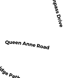
0 PARTRIDGE PATH
Owner Information
PARTRIDGE PATH OWNERS ASSOCIATION
20 PARTRIDGE PATH
CHATHAM, MA 02633


Property Details
0 PARTRIDGE PATH is classified as a Undevelopable Residential Land.
0 PARTRIDGE PATH is valued at $3,300. The land is valued at $3,300 and the structures are valued at $0.
This property is in Zone R60. Confirm with local Zoning Board authorities to ensure there are no overlays or other easements on this property.
The most recent deed for 0 PARTRIDGE PATH is recorded at the local registrar in Book 2368, Page 47. 0 PARTRIDGE PATH was last sold on Monday, July 12, 1976 for $1.
Assessment data from fiscal year 2018.
Flood Data
According to the FEMA National Flood Hazard Layer, this property does not appear to be in a flood zone. It may also be in an area not yet reviewed. Nonetheless, confirm this information prior to taking any action.
To view the flood hazards around this property, create a FEMA "Firmette" Map of the area around 0 PARTRIDGE PATH.
Broadband Internet Providers
| Provider | Type | Bandwidth (mbps) | |
|---|---|---|---|
| Verizon New England Inc. | DSL | 5 | 0 |
| Viasat Inc | Satellite | 35 | 3 |
| HughesNet | Satellite | 25 | 3 |
| GCI Communication Corp. | Satellite | 0 | 0 |
| T-Mobile | Fixed Wireless | 25 | 3 |
| Comcast | Cable | 1000 | 35 |
| VSAT Systems, LLC. | Satellite | 2 | 1 |
Broadband service provider data from December 2020.
Adjacent Properties
- 0 OLD QUEEN ANNE RD
Vacant, Conservation (Municipal or County) owned by TOWN OF CHATHAM - 46 PARTRIDGE PATH
Single Family Residential owned by LAMB GARY D & MARIA V - 20 PARTRIDGE PATH
Single Family Residential owned by KELLEY SCOTT C & LINDA J T/E - 0 MALLARD RD
Developable Residential Land owned by KELLEY SCOTT C & LINDA J T/E